Caracas
Essential travel Guide to Venezuela’s Vibrant Capital

Located in South America; Caracas stands as the capital and largest city of Venezuela, set in a narrow valley near the Caribbean Sea and backed by steep mountains. You find it about 900 meters above sea level, where warm days mix with a mild, spring-like climate for much of the year. Caracas gives you a direct look at Venezuela’s political, cultural, and economic heart in one fast-moving city.
You walk through plazas shaped by Spanish colonial rule, pass modern towers built during the oil boom, and see daily life unfold in busy streets and markets. The city has faced deep economic and political challenges in recent years, yet it remains the country’s main center for government, business, and culture.
When you explore Caracas, you experience sharp contrasts. Historic churches sit near concrete high-rises, and green mountain views frame crowded urban neighborhoods. This mix of history, geography, and daily life makes the metropolitan district of caracas and worth understanding.
Key Takeways
Caracas sits in a mountain valley near the Caribbean and serves as Venezuela’s capital.
The city blends colonial roots, oil-era growth, and modern political change.
- Considered venezuela’s cultural capital
Daily life reflects strong cultural traditions alongside ongoing economic challenges.
Central Venezuela
More Destination
REQUEST

Geography and Climate
Caracas is located in a mountain valley close to the Caribbean coast. Its elevation, rivers, and tropical savanna climate shape daily life, water supply, and urban growth.
The Caracas Valley and its surroundings
You find caracas is located along the Caracas Valley, about 7 miles (11 km) south of the Caribbean Sea. The city stands at about 3,025 feet (922 m) above sea level, which keeps temperatures milder than the coast.
Mountains of the Venezuelan Coastal Range surround you on all sides. To the north rises Cerro El Ávila, also called El Ávila, which reaches more than 8,600 feet (2,600 m) at Pico El Ávila. This steep wall limits expansion toward the sea.
Much of the city lies within the Capital District, though urban areas spread into nearby Miranda state. The Spanish founded the city as Santiago de León de Caracas in 1567 on this protected valley floor.
The valley runs about 15 miles (25 km) east to west. Steep slopes and limited flat land have shaped dense neighborhoods and hillside housing.
Major Rivers and Natural Features
Several rivers cross the valley and drain toward the Tuy River basin. The most important urban waterway is the Guaire River, which runs through central Caracas.
The Guaire collects water from smaller rivers such as the San Pedro River and the El Valle River. These streams once supported farming and daily life. Today, heavy urban use has reduced water quality.
To the south, the La Mariposa Reservoir stores water for the metropolitan area. It plays a key role in your water supply, especially during the dry season.
To the north, El Ávila National Park protects forested mountain slopes. The park preserves native plants and wildlife and acts as a natural barrier between Caracas and the coast.
Tropical Savanna Climate Patterns
Caracas has a tropical savanna climate under the Köppen climate classification. Elevation makes it cooler than lowland tropical cities.
Temperatures usually range from about 62°F to 84°F (17°C to 29°C) during the year. Monthly averages stay near 70°F (21°C), with little change between January and May.
You experience two main seasons:
- Rainy season: May to November
- Dry season: December to April
Most Caracas precipitation falls during the rainy months. Annual rainfall averages about 32 inches (800 mm), with heavier showers in late summer and early fall.
The dry season brings clearer skies and slightly cooler nights. This steady climate supports year-round activity, but heavy rains can strain roads and drainage in low-lying areas near the Guaire River.
Our Travel Packages


History and Development: Santiago de Leon de Caracas
Caracas grew from a small colonial settlement into Venezuela’s political and economic center. You can trace its path through conquest, independence, disaster, oil wealth, and rapid urban change.
Founding and Colonial Era in 1567
You can date the city’s formal founding to 1567, when Diego de Losada established Santiago de Leon de Caracas. Earlier, Francisco Fajardo tried to settle the valley in the 1550s, but Indigenous resistance forced settlers out.
Spanish leaders laid out the town in a grid around a central plaza. Farms and cacao plantations soon spread across the valley.
In 1577, Caracas became the capital of the province. Governor Juan de Pimentel helped strengthen its political role.
Later, the city became part of the Captaincy General of Venezuela, created in 1777. The Guipuzcoan Company of Caracas controlled much of the cacao trade in the 1700s, tying the city to global markets.
Disaster and attack shaped colonial life. The English privateer Amyas Preston, during the Preston–Somers expedition with George Somers, raided Caracas in 1595. The 1641 earthquake destroyed many buildings and forced rebuilding around the city.
Key Historical Events
You can see Caracas at the center of Venezuela’s fight for independence. On July 5, 1811, leaders in the city signed the Venezuelan Declaration of Independence from Spain.
Simón Bolívar, born in Caracas in 1783, led military campaigns across northern South America. After setbacks and exile in Nueva Granada, he returned to continue the struggle.
The Battle of Carabobo in 1821 secured independence for Venezuela. Caracas then became the capital of the new republic after it separated from Gran Colombia in 1830.
The city also witnessed early reform efforts. The Gual and España Conspiracy in 1797 called for equality and an end to Spanish rule, though authorities crushed it.
In 1989, economic unrest led to the Caracazo. Protests over rising prices and transport fares turned violent. Security forces responded with force, and hundreds died. This event reshaped national politics and public trust.
Urban Expansion and Modernization
You can link Caracas’s modern shape to the rule of Antonio Guzmán Blanco in the late 1800s. He ordered new boulevards, public buildings, and monuments inspired by Paris. Rail lines connected the city to the coast.
The 20th century brought oil wealth and fast growth. After 1936, governments invested in housing, roads, and public works. Highways and high-rise buildings changed the skyline.
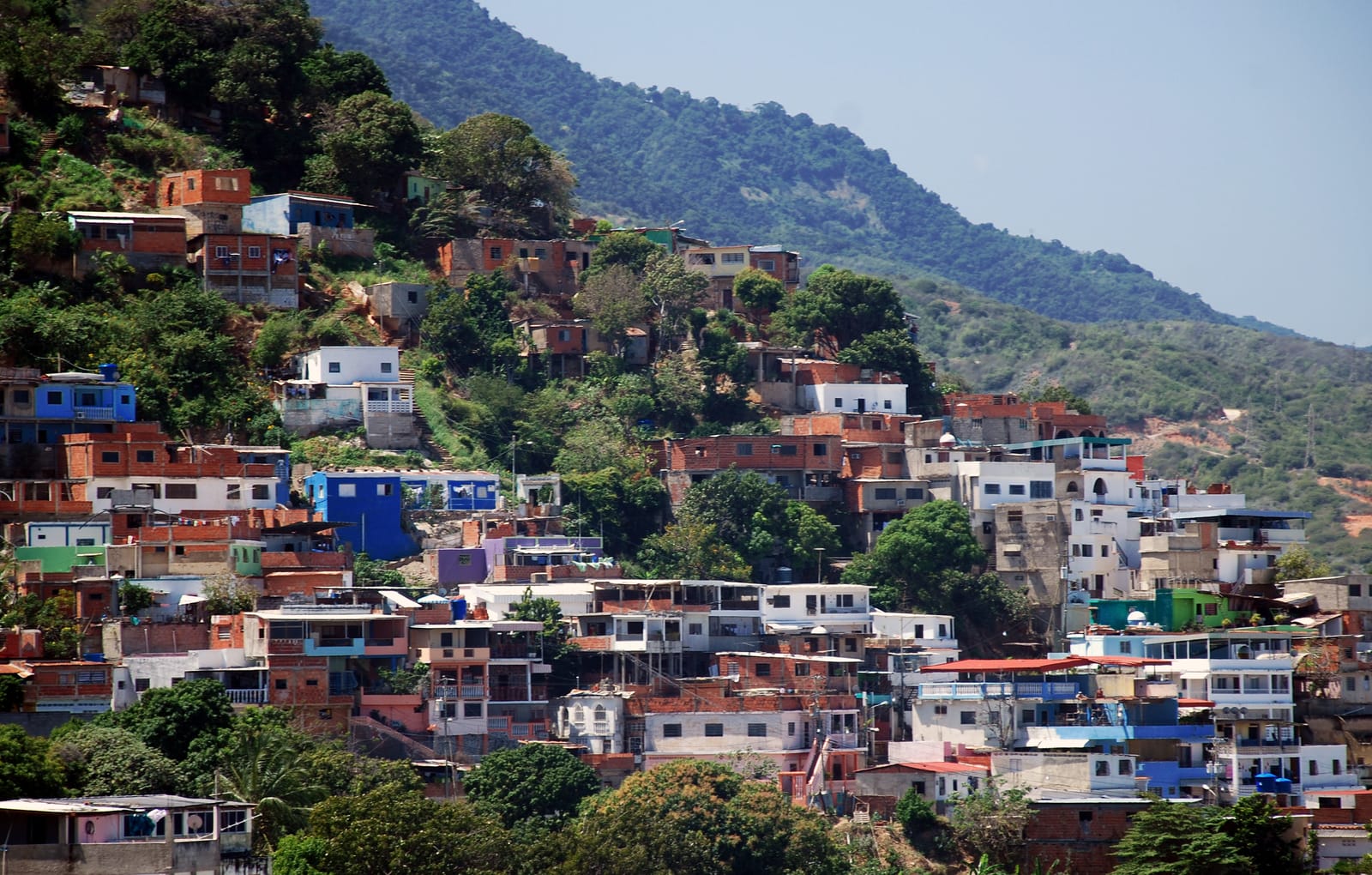
From the 1950s to the 1970s, the population surged into the millions. Rural migrants settled in hillside barrios, often building homes without formal services.
Rapid growth strained water, transport, and housing systems. Earthquakes, including a major one in 1967, exposed weak infrastructure.
You now see a city shaped by colonial grids, independence-era landmarks, and modern highways. Each stage of development left visible marks on its streets and neighborhoods.

City Structure and Key Districts
Caracas spreads across a narrow valley and into nearby hills, forming a dense urban core and wide metropolitan area. You can see clear divisions between historic centers, modern business zones, hillside neighborhoods, and major transport corridors.
Municipalities and Metropolitan Region
You experience Caracas as part of a larger urban area known as Greater Caracas, also called Gran Caracas or the Metropolitan Region of Caracas. This region includes five main municipalities:
- Libertador (Capital District)
- Chacao
- Baruta
- Sucre
- El Hatillo
Libertador holds the historic and political heart of the city. It contains Plaza Bolívar, Miraflores Palace, and many national government buildings. It also includes the dense downtown and older districts.
Chacao and Baruta sit to the east and southeast. They include major business and residential zones such as El Rosal and Las Mercedes. Sucre covers large eastern areas and hillside communities. El Hatillo lies farther south, with a more suburban layout and colonial-style buildings.
Beyond the core, the wider metropolitan area connects to Los Teques through the Central Regional Highway.
Landmarks, museum and Architecture
You find key landmarks in the historic center of Libertador. Plaza Bolívar marks the colonial core and stands near the Caracas Cathedral. These buildings reflect Spanish colonial design with thick walls and central courtyards.
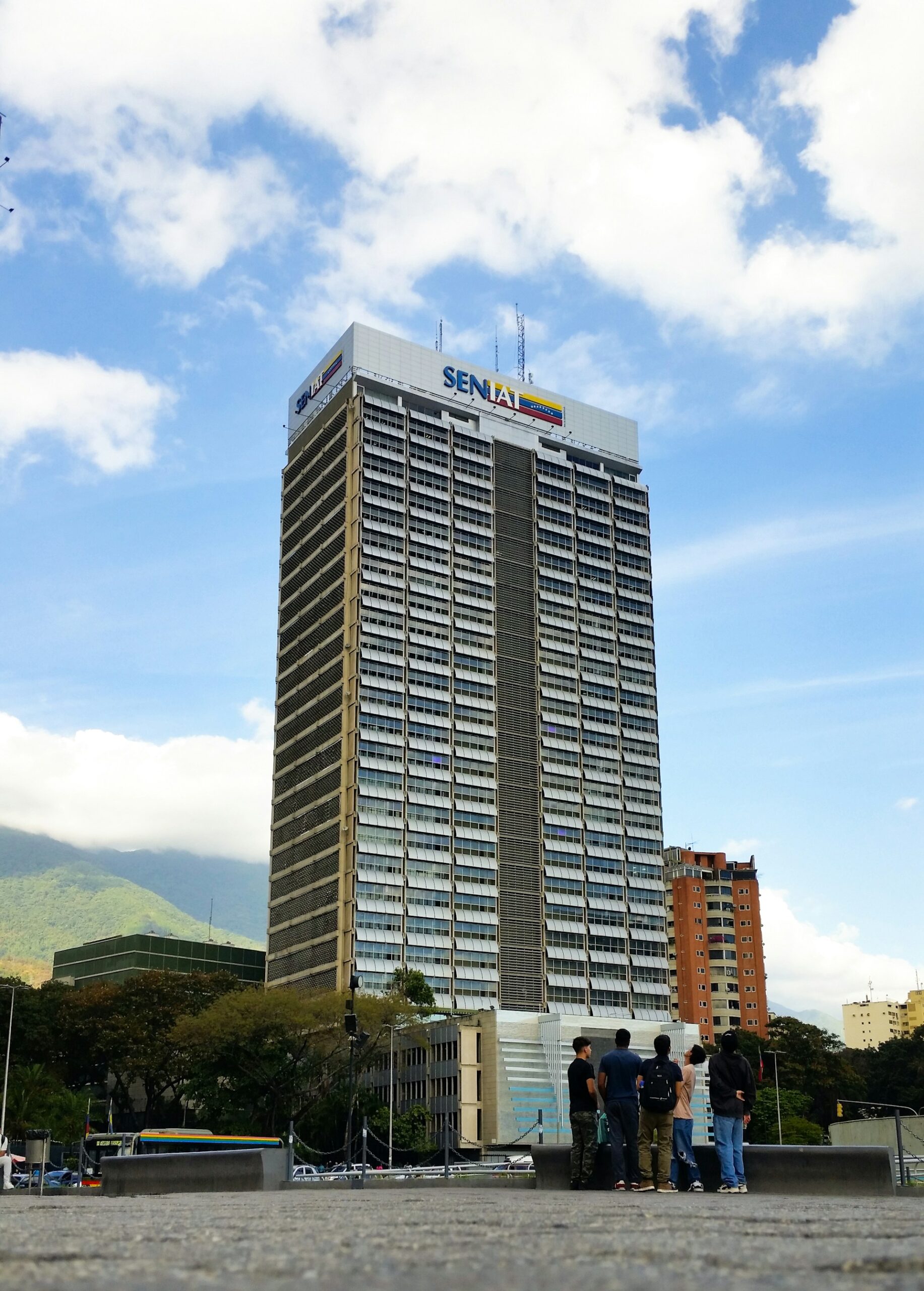
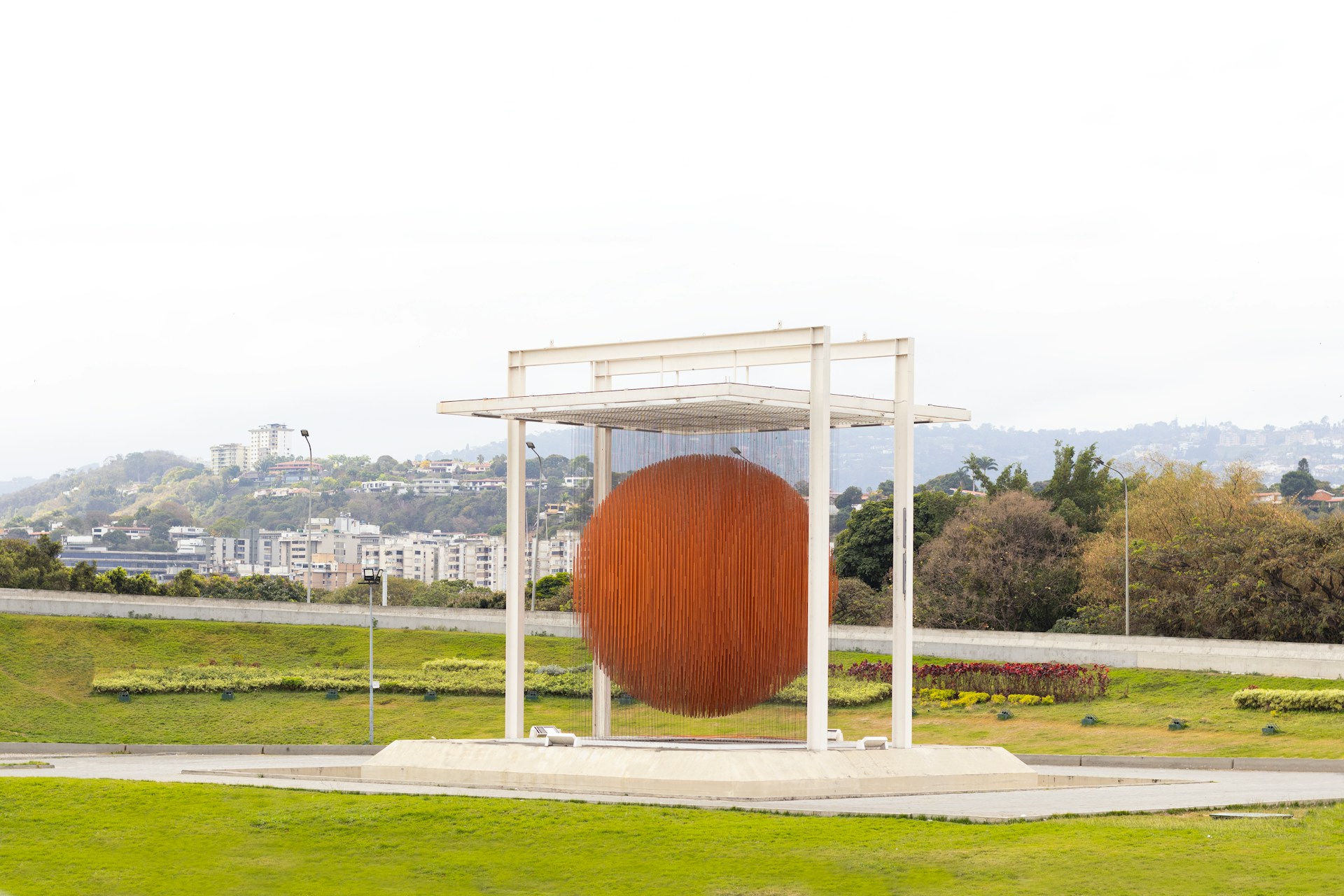
Modern Caracas rises around Parque Central, once the tallest complex in Latin America. The Parque Central Towers dominate the skyline. Nearby, the Simón Bolívar Centre shows mid-20th-century modernist planning.
The University City of Caracas, designed by Carlos Raúl Villanueva, stands out for its modern architecture and integration of art and open space. UNESCO recognizes it as a World Heritage Site. Close by, you can visit the Teresa Carreño Cultural Complex, one of the country’s main performance venues, and the Museum of Contemporary Art of Caracas.
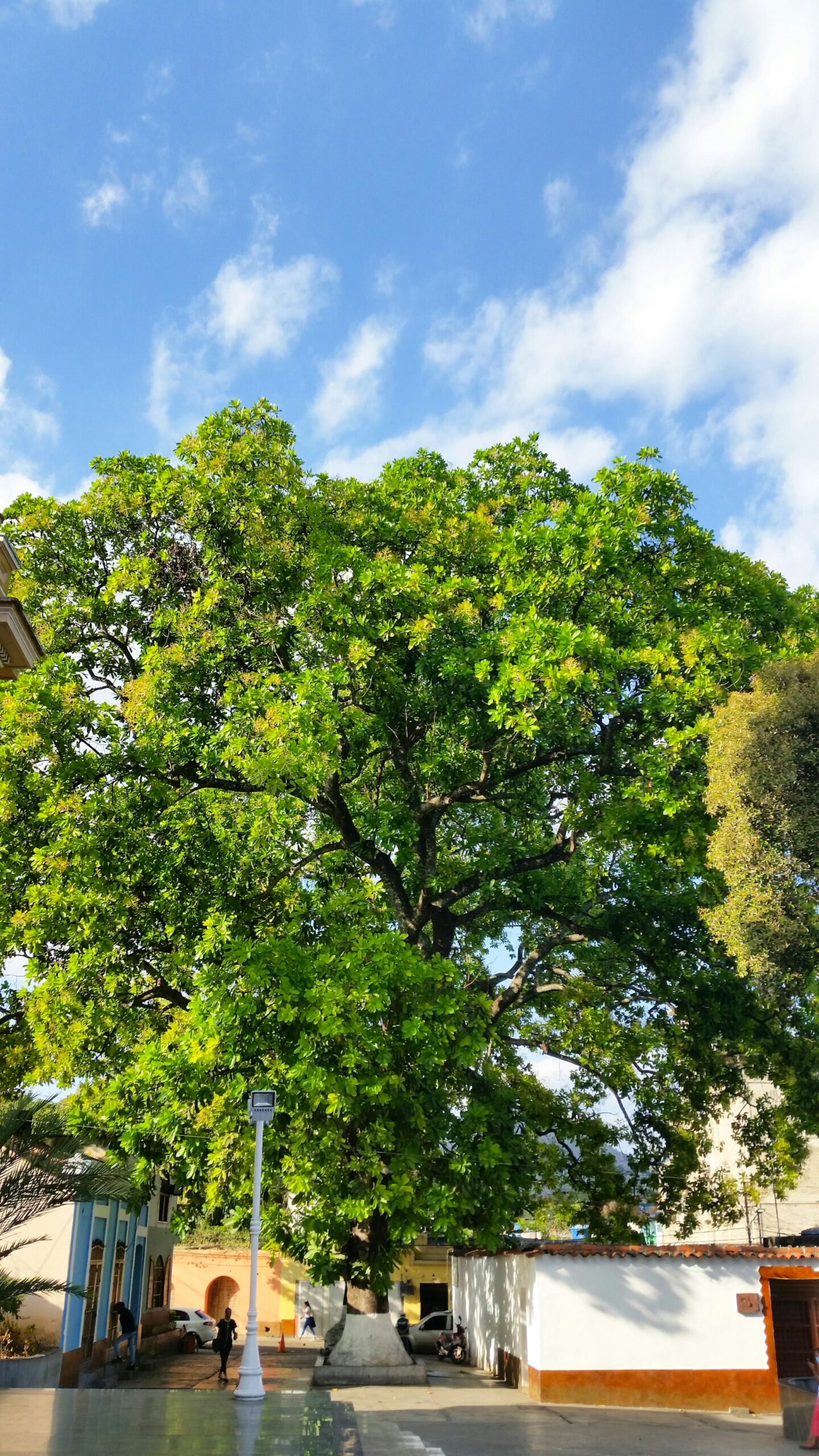
Green space also shapes the city. Parque Los Caobos and Plaza Venezuela anchor important civic and cultural zones.
Neighborhoods and Urban Areas
Caracas includes sharp contrasts between planned districts and informal hillside settlements. You see this clearly when moving from business centers to outer slopes.
Sabana Grande serves as a busy commercial corridor with shops, offices, and pedestrian streets. El Rosal and Las Mercedes function as financial and nightlife centers, with office towers and restaurants.
Older neighborhoods like La Candelaria reflect European immigration, especially Spanish and Portuguese communities. Narrow streets and mid-rise apartments define the area.
Along hillsides and near waterways such as the Quebrada Baruta, you find dense informal housing. These areas grew quickly during the 20th century as migration increased. They often lack the uniform layout found in planned districts.
Infrastructure and Transportation
You rely on a mix of highways, airports, and public transit to move through Caracas. The valley setting limits expansion and concentrates traffic along key routes.
The Central Regional Highway links Caracas to central Venezuela and to Los Teques. The Gran Mariscal de Ayacucho Highway connects the capital with eastern suburbs and coastal areas.
For air travel, you use Simón Bolívar International Airport in Maiquetía, which handles most international and domestic flights. Francisco de Miranda Airport serves smaller private and military aircraft within the city.
Major avenues connect hubs like Plaza Venezuela with business districts and government centers. Heavy traffic and the narrow valley shape daily movement patterns across the metropolitan area.

Society, Economy, and Daily Life
Caracas shapes daily life through its dense population, oil-based economy, major universities, and strained public services. You see sharp contrasts between wealth and poverty, modern transit lines and informal hillside housing.
Population and Demographics
Caracas has an estimated population of over 3 million people. The city sits in a narrow valley, which limits space and pushes housing up the hillsides.
You live among a mix of European, African, and Indigenous heritage, which shapes food, music, and local customs. Spanish is the main language, and Catholicism remains the largest religion.
Large working-class communities fill western districts such as 23 de Enero and parts of Sucre Municipality, including Petare, home to Deportivo Petare. Many families live in informal housing known as barrios, often built on steep slopes.
Wealthier residents tend to live in eastern areas like Chacao and Baruta. In daily life, you notice strong neighborhood ties, busy street markets, and heavy commuter traffic each morning.
Caracas: Venezuela economic hub
Caracas serves as Venezuela’s financial and political center. The economy depends heavily on oil, led by Petróleos de Venezuela (PDVSA), the state-owned energy company headquartered in the city.
Oil revenue has shaped public spending and private business for decades. When oil prices fall or production drops, you feel the impact through inflation, shortages, and reduced services.
The Caracas Stock Exchange operates on a smaller scale than major global markets but remains active. Large private firms such as Empresas Polar, a major food producer, also play a key role in the local economy.
Many people work in government, retail, transport, and informal trade. Street vendors and small shops form a visible part of daily economic life, especially during periods of currency instability.
Education and Major Institutions
Caracas anchors Venezuela’s higher education system. The Universidad Central de Venezuela (Central University of Venezuela) stands as the country’s most important public university.
Its campus, a UNESCO World Heritage Site, includes modernist architecture and major research centers. Students study medicine, engineering, law, and social sciences.
The Universidad Simón Bolívar focuses on science and technology. It produces many engineers and researchers who often work in energy and telecommunications.
Despite strong academic traditions, universities face funding shortages and faculty migration. Even so, you still find active student groups, public lectures, and cultural events across campuses.
Public Services and Social Challenges
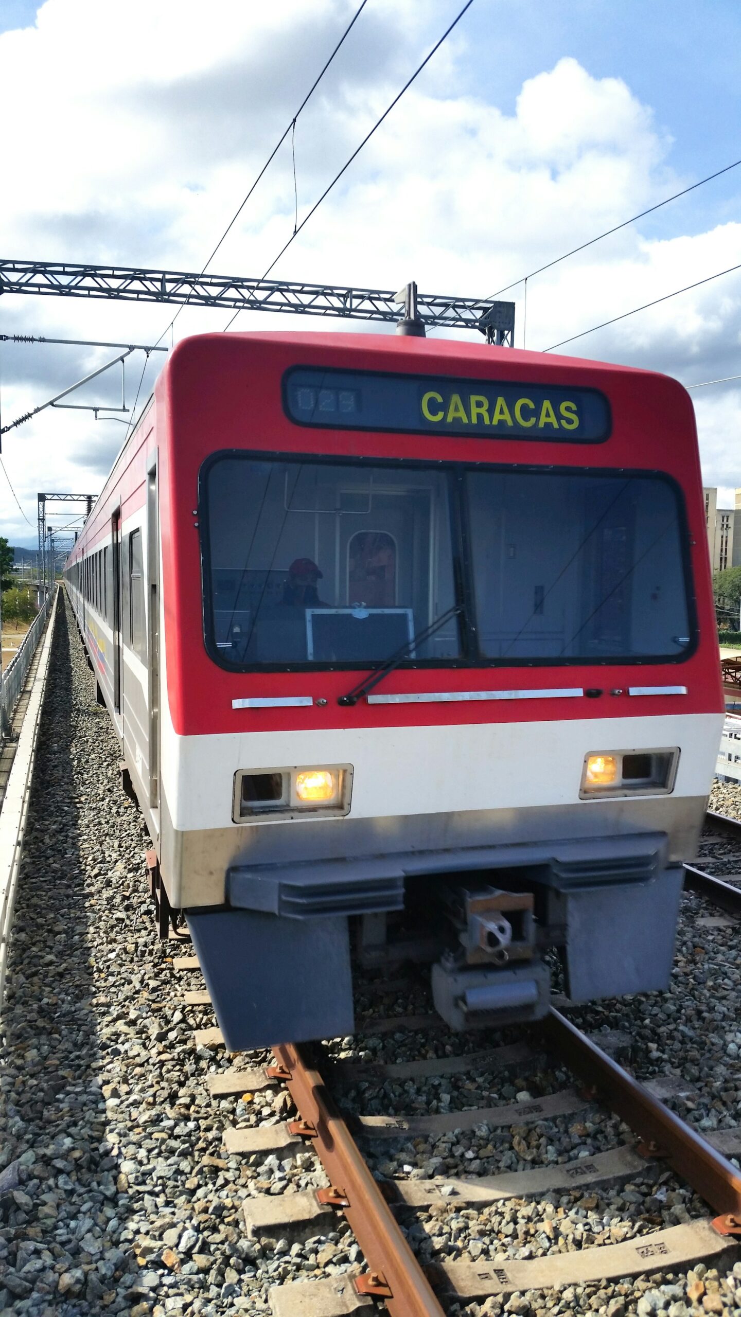
Public transport moves millions each day. The Metro de Caracas forms the backbone of the system, connecting key districts through several lines.
The network links to Metrobús, Metrocable, and BusCaracas, a bus rapid transit line. Regional rail connects through stations such as Ezequiel Zamora, with service toward Charallave and Cúa. The Los Teques Metro links the capital to nearby cities.
Service quality varies. Delays and maintenance issues occur, especially during economic downturns.
Healthcare and utilities face pressure from inflation and limited funding. Many residents in barrios lack reliable water service and secure housing.
Crime and safety remain concerns in parts of the city. At the same time, civic groups, churches, and local organizations work to support vulnerable communities and improve daily life.
The best places to visit in Caracas
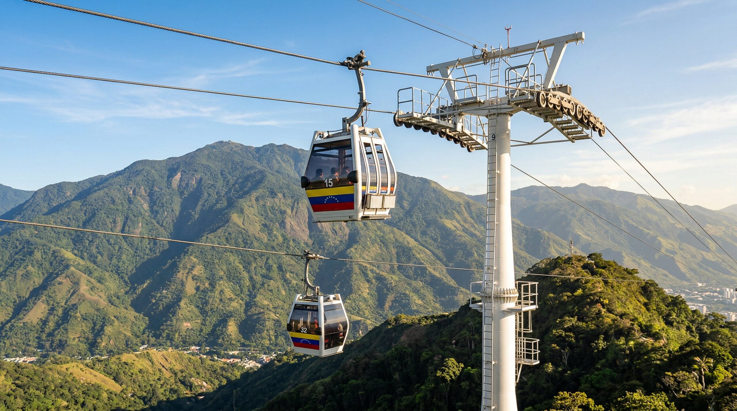
You can see in Caracas some amazing sights. You can start with El Ávila National Park, which rises above the city. Hike marked trails or ride the cable car for wide views of Caracas and the Caribbean coast. Visit during the dry season, from December to April, for clearer skies. To enjoy the best temperature in caracas .
Head next to Plaza Bolívar in the historic center of the city. You will see colonial buildings, the Caracas Cathedral, and the Municipal Palace around the square. Walk a few blocks to the National Pantheon, where Venezuela honors Simón Bolívar and other national figures. From there, you’ll have a view of the city
Spend time outdoors at Los Caobos Park or the Jardín Botánico. These green spaces offer shaded paths, sculptures, and native plants. You can walk, relax, or take simple photos without leaving the city.
Explore culture at the Museum of Contemporary Art. You will find works by Venezuelan and international artists in a modern setting. Check local listings for current exhibits.
For city views, stop at the Mirador de la Cota Mil. Go near sunset for cooler air and a clear look at the skyline.
Best Places to Visit in Caracas
| Place | Location | Recommended Visiting Time | Activities | Type of Visitors | Tourist Value |
|---|---|---|---|---|---|
| El Ávila National Park | North of Caracas | Morning (8:00 AM – 11:00 AM) Best season: Dec–Apr | Hiking, cable car ride, panoramic photography | Nature lovers, couples, adventure travelers | Best clear skies during dry season. Bring water and hiking shoes. |
| Plaza Bolívar | Historic Downtown | 9:00 AM – 5:00 PM | Colonial architecture tour, photography, city walks | Families, history enthusiasts, students | Central starting point to explore the Cathedral and historic buildings. |
| National Pantheon | Av. Urdaneta | 9:00 AM – 3:00 PM | National history visit, Bolívar memorial | Cultural tourists, school groups | Free entry. Short but meaningful historical visit. |
| Los Caobos Park | Central Caracas | Morning or Late Afternoon | Walking, relaxing, sculpture viewing | Families, locals, joggers | Urban green space near major museums. |
| Caracas Botanical Garden | University City Area | 8:00 AM – 4:00 PM | Plant observation, nature walks, photography | Eco-tourists, students, photographers | UNESCO World Heritage site with tropical plant collections. |
| Museum of Contemporary Art | Los Caobos Area | 10:00 AM – 4:00 PM | Modern art exhibitions | Art lovers, cultural travelers | Check current exhibitions before visiting. |
| Mirador de la Cota Mil | Avenida Boyacá | Sunset (5:30 PM – 7:00 PM) | City skyline views, photography | Couples, photographers, urban explorers | Best panoramic views at sunset with cooler temperatures. |

Frequently Asked Questions
You may want clear facts about population, safety, location, and history before you plan a visit. These points help you understand how Caracas functions today and why it matters.
The population of Caracas is between 2 to 3 million people within the city limits. The larger metropolitan area holds around 4 to 5 million residents.
You will find dense neighborhoods in central districts and large residential zones that spread into nearby valleys. The city grew slowly continues to grow outward due to limited flat land.
Yes, it's safe, although as with any trip, it's recommended that you avoid walking around at night, carrying valuables in plain sight, or venturing into unfamiliar neighborhoods without a local guide.
Caracas sits in northern Venezuela, about 15 kilometers (9 miles) south of the Caribbean Sea. A mountain range called El Ávila separates the city from the coast.
The metro area stretches along a narrow valley. On a map, you will see long east‑west development with steep hills rising on both sides.
Major urban areas include Libertador, Chacao, Baruta, Sucre, and El Hatillo. Highways connect the city to the port of La Guaira and to inland regions.
Caracas was founded in 1567 by Spanish colonists. It later became the birthplace of Simón Bolívar, a key leader in Latin America’s independence movements.
You can visit Bolívar’s birthplace and several colonial churches in the historic center. The city also hosts national government buildings, major universities, and cultural institutions.
Caracas remains the political, financial, and cultural center of Venezuela. National events, protests, and major policy decisions often begin here.
Yes, Caracas has a metro system called the Caracas Metro (Metro de Caracas). It opened in 1983 and is the main public transportation system in the city. The metro connects key areas of Caracas, including downtown, residential neighborhoods, and commercial districts. It is one of the fastest and most affordable ways to move around the capital.
Caracas is famous for being the capital of Venezuela and the birthplace of Simón Bolívar, one of Latin America’s most important historical leaders.
The city is also known for its dramatic natural setting, surrounded by El Ávila National Park (Waraira Repano), which separates Caracas from the Caribbean coast. This unique combination of mountains, modern urban life, and colonial history makes Caracas culturally and geographically distinctive in South America.
The official and most widely spoken language in Caracas is Spanish.
You may also hear basic English in hotels and tourist areas, but Spanish is the primary language used in daily life, business, and government.
The official currency in Caracas is the Venezuelan Bolívar (VES).
However, US dollars are widely accepted in many businesses, especially in tourist areas, restaurants, and hotels. It is recommended to carry small bills if paying in US dollars.
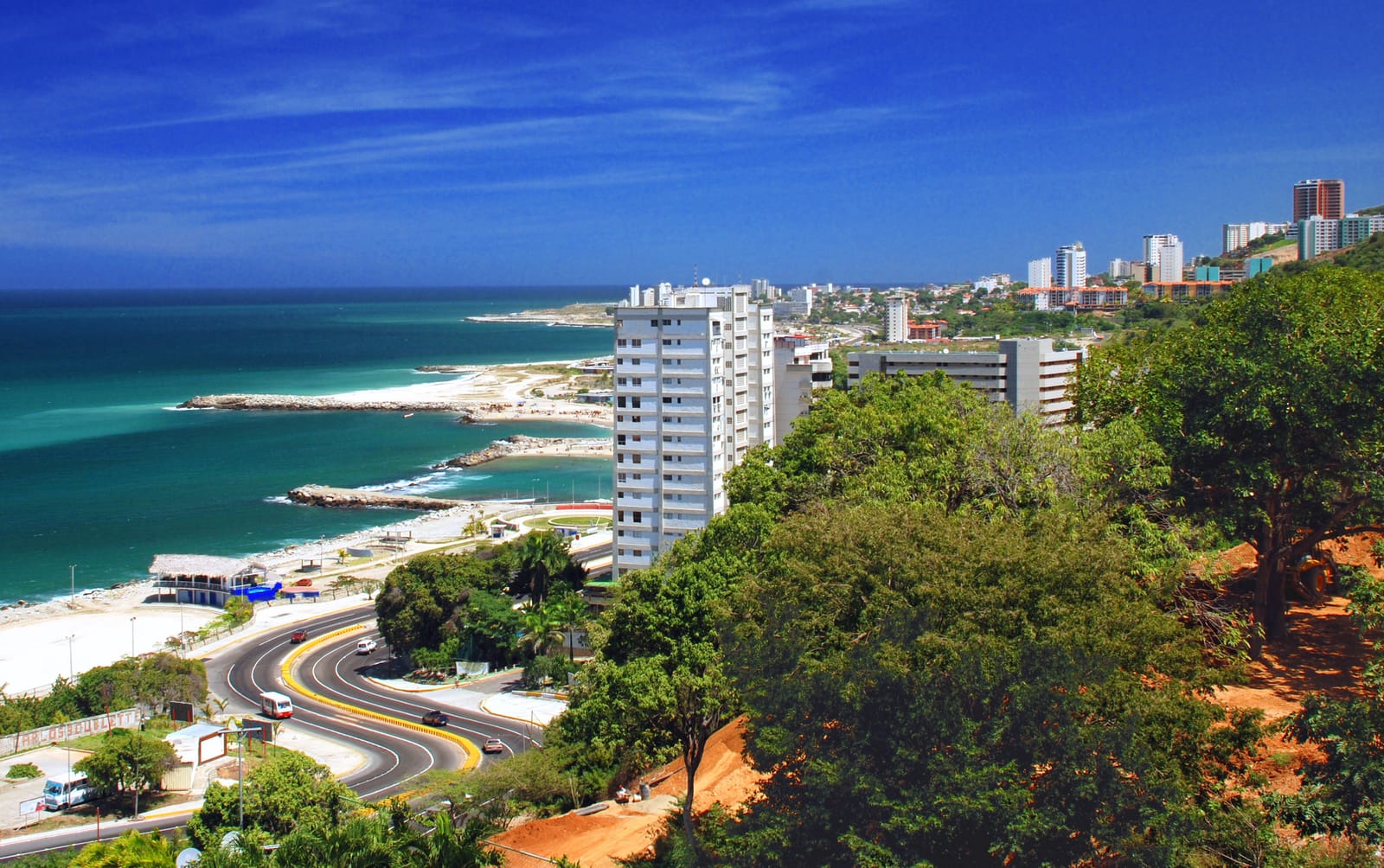
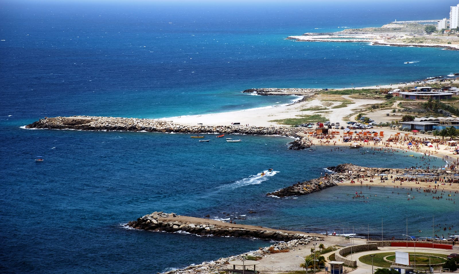
Caracas itself does not have beaches directly within the city.
However, beautiful Caribbean beaches are located just 30 to 60 minutes away, across El Ávila mountain. The most popular beach area is La Guaira (Vargas State), where visitors can enjoy crystal-clear waters, coastal towns, and seaside restaurants.
This close proximity to the Caribbean Sea makes Caracas unique among South American capitals.
The name Waraira Repano comes from the language of the Indigenous Carib peoples who originally inhabited the region before the Spanish arrived.
Although there are different interpretations, it is commonly understood to mean “Great Mountain” or “Mountain Range by the Sea.” The name reflects the park’s dramatic geography — a massive coastal mountain range that rises between Caracas and the Caribbean Sea.
In 2011, the Venezuelan government officially restored the Indigenous name, changing it from El Ávila National Park to Waraira Repano National Park as a way to recognize the area’s pre‑colonial heritage and Indigenous cultural roots.
Today, many locals still use both names interchangeably.