
La Guaira In Venezuela
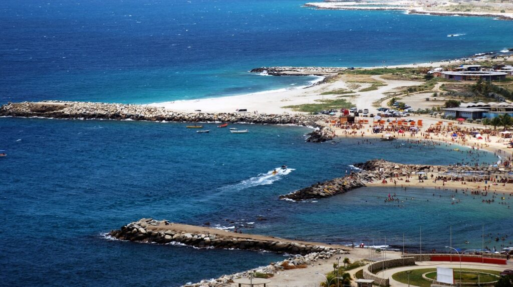
La Guaira sits at the edge of the Caribbean Sea, pressed between steep coastal mountains and the water, about 25 kilometers north of Caracas. It is Venezuela’s main port city and the capital of La Guaira State, and it occupies a place in the country’s geography and history that most travelers pass through without fully registering.
The city was founded in 1577 as the coastal outlet for Caracas, and that single function, linking an inland capital to the sea, has shaped everything about it: its layout, its fortifications, its colonial architecture, and its modern role as the entry point for the majority of international arrivals into Venezuela.
For anyone planning a trip that reaches into the interior, whether to Angel Falls, the Gran Sabana, or the Orinoco Delta, La Guaira is often the quiet starting point. Understanding its geography, history, and current context makes it easier to plan what comes next. If you are ready to start building your Venezuela itinerary, the team at Venezuela Nature can help you connect the logistics from the moment you land.
Key Takeways
- La Guaira has been Venezuela’s principal sea gateway since the late 16th century, a role that still defines its geography and infrastructure today
- The city holds significant colonial heritage, including fortifications and historic buildings, and appears on UNESCO’s Tentative World Heritage List.
- The 1999 floods and mudslides permanently altered the urban landscape, and understanding that history is relevant for any traveler moving through the region.
Where La Guaira Sits In Venezuela
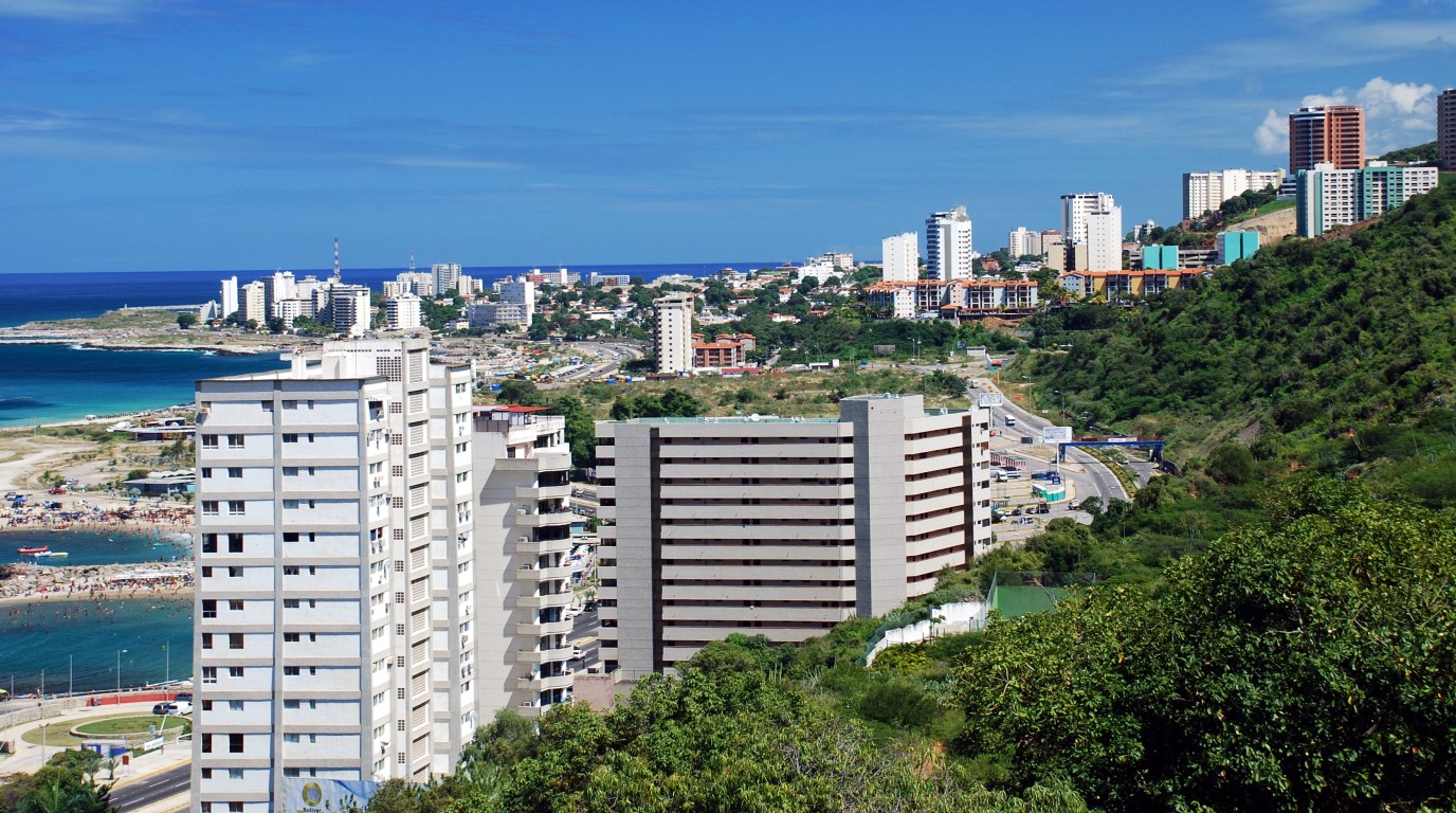
La Guaira occupies a narrow strip of the Venezuelan coast where the Coastal Mountain Range drops almost directly into the Caribbean Sea. The surrounding geography leaves very little flat land for the city to expand, which explains much of its compact, layered urban character. Two key relationships define the city’s position: its connection to Caracas and the airport at Maiquetía.
Its Relationship With Caracas And The Capital Region
La Guaira is located approximately 25 kilometers northwest of Caracas, the capital city of Venezuela. The two cities are separated by a dramatic mountain wall, historically crossed by mule trail and today connected by a modern highway descending the coast range.
In 1998, La Guaira became the capital city of the newly created La Guaira State, which was carved out of the former Federal District. Before that reorganization, the coastal zone had been administered as part of the greater Caracas capital region. That administrative separation gave La Guaira its current status as a state capital while maintaining its functional dependence on Caracas for much of the country’s trade and transit.
The Caribbean Coast, Vargas, And La Guaira State
La Guaira State, formerly named Vargas State until 2019, is one of 23 states of Venezuela. It occupies a coastal zone running along the northern edge of the country, bordering Aragua to the west and Miranda to the east.
The state is narrow by Venezuelan standards. It is defined almost entirely by the strip of coast between the mountains and the Caribbean Sea, with very limited agricultural or flat land. The city of La Guaira serves as the state capital within Vargas Municipality. Catia La Mar is also a key urban center nearby, known for its busy commercial streets and residential neighborhoods.
Maiquetía Airport And Why The City Matters To Arrivals
Simón Bolívar International Airport, located in the adjacent town of Maiquetía, handles roughly 90 percent of Venezuela’s international air traffic. The airport sits right next to La Guaira along the same coastal strip, bordering the town of Catia La Mar. This proximity makes Catia La Mar a frequent stop for travelers needing local services near the terminal.
For most international travelers, La Guaira and Maiquetía are effectively the same arrival zone. The drive to Caracas from the airport takes roughly 20 minutes in light traffic, though the winding mountain road can extend that significantly. Coordinating transfers in advance through an experienced local operator avoids most of the friction that comes with informal transport options at this junction.
Our Travel Packages

A Port City Shaped By Trade And Strategy
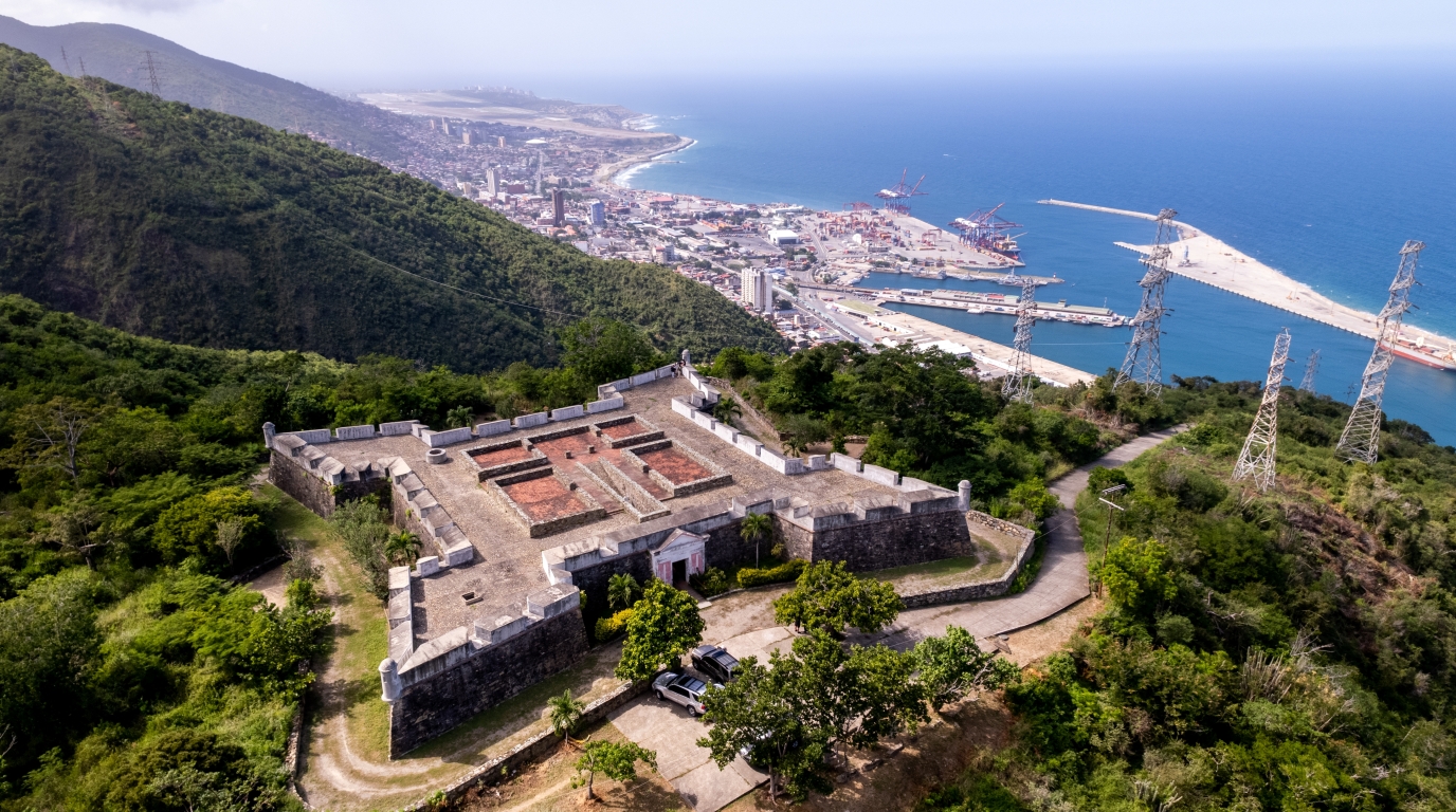
The Port of La Guaira did not develop by accident. It was built to serve a specific geographic need, and its history as Venezuela’s main port reflects centuries of commercial and military pressure on a small, exposed stretch of the Caribbean coast. The fortifications that still stand in parts of the historic center reflect just how seriously that exposure was taken.
Founded In 1577 As An Outlet For Caracas
Caracas was founded by the Spanish in 1567, but it sat inland, cut off from direct sea access by the coastal mountains. La Guaira emerged shortly after, founded in 1577 as an outlet that would allow the capital to trade. Some sources place the formal establishment of the port at 1589, reflecting different stages of its early development.
From the beginning, the city’s purpose was functional rather than residential. It existed to move goods between the sea and the interior, and that narrow commercial identity shaped how it was built and governed.
The Country’s Main Port And Its Historic Harbour Role
During the 18th century, La Guaira became an important harbour, heavily involved in the export of cocoa produced along the coastal valleys. The Royal Gipuzkoan Company of Caracas, a Spanish trading monopoly also known as the Guipuzcoana Company, controlled both La Guaira and Puerto Cabello during this period and organized large-scale cocoa production across the region.
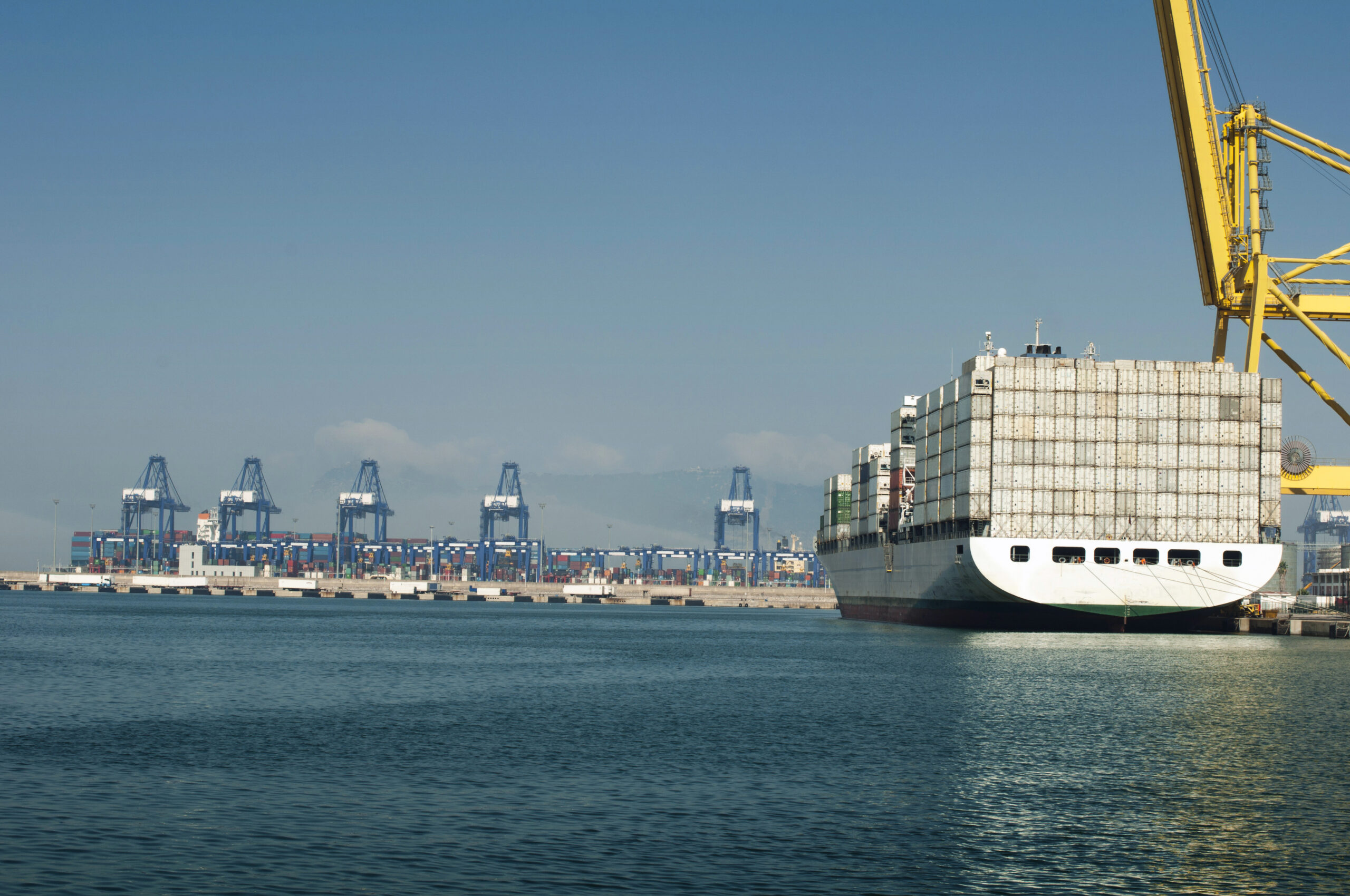
Today, La Guaira is ranked the second most important port in Venezuela after Puerto Cabello. It handles containerized cargo, general freight, and breakbulk goods, and remains the primary maritime connection between Caracas and international shipping routes across the Caribbean and Atlantic.
Fortifications, Shipping, And Coastal Defense
Because La Guaira was the main entry point to the Venezuelan capital, it was a persistent target for foreign attacks. Buccaneers and the naval forces of England, the Netherlands, and France all pressured the port at various points. In response, Spanish colonial authorities transformed it into a fortified, walled city.
The Castillo de San Carlos and the Castillo de San Joaquín are among the significant landmarks surviving from this era. These fortifications were essential for protecting the coast of La Guaira in Venezuela from maritime threats. A notable engagement occurred in March 1743 during the War of Jenkins’ Ear, when a British squadron of 19 ships under Admiral Charles Knowles attacked the port and was repelled by Venezuelan coastal batteries. The city was also badly damaged by the earthquake of March 26, 1812, the same year privateers from the United States and Britain clashed in the waters just offshore.
Historical Layers And Built Heritage
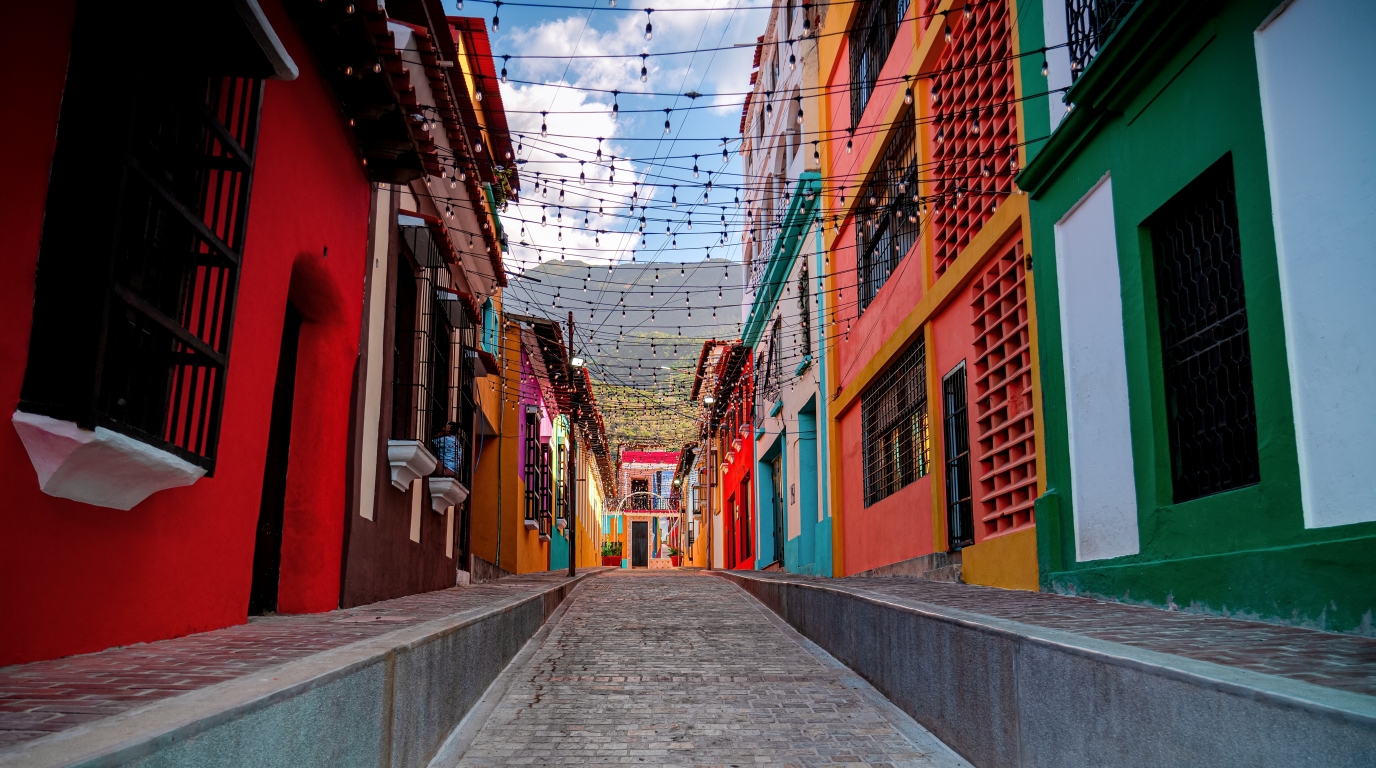
La Guaira’s historic center contains one of the more intact concentrations of colonial-era architecture on Venezuela’s Caribbean coast. The buildings are modest in scale, built close together on narrow streets, and many have survived in recognizable form despite the 1999 disaster and the pressures of urban change. The city appears on UNESCO’s Tentative List, and several local landmarks serve as physical reminders of its long strategic history. The route connecting it to Caracas also carries significant heritage value.
Colonial Architecture And Low-Rise Coastal Buildings
The historic center is characterized by low-rise and traditional buildings constructed during the colonial period. Facades with wooden details, shaded interior courtyards, and thick walls adapted to the heat define the architectural character of the older neighborhoods.
Of 632 buildings recorded in the historic center following the 1999 mudslides, a significant number retained structural value. The Guipuzcoan Company building, where cocoa traders once conducted business, is among the more recognizable surviving structures. Walking through the older streets gives a clear sense of how compact and dense the colonial port town originally was.
Camino De Los Españoles And Links To The Interior
The Camino de los Españoles, or Road of the Spaniards, was constructed to connect La Guaira to Caracas through the mountain range that separates them. Built as a colonial trade route, it became one of the most economically and strategically significant roads in Venezuela’s early history.
The road predates the modern highway and follows a different path through the mountains. Sections of it survive as a hiking and heritage trail today, offering a physical connection to the same route that once carried cocoa, coffee, and goods between the port and the capital. For travelers interested in Venezuela’s colonial period, the Camino de los Españoles is one of the more specific and tangible attractions in the region.
UNESCO Interest And Heritage Recognition
La Guaira appears on Venezuela’s contribution to UNESCO’s Tentative List, recognized for its historic center’s role as the country’s founding port and its surviving colonial-era built environment. The listing is described in the UNESCO records with reference to the city’s founding, its function as an important harbour, and the construction of the Camino de los Españoles as a road of strategic and economic value.
Tentative List status indicates that the site is being considered for nomination rather than confirmed World Heritage status, but the recognition reflects the genuine heritage density of the historic center.
Climate, Landscape, And Coastal Character
The physical setting of La Guaira is one of the most constrained of any city on Venezuela’s coast. Steep mountains rise almost immediately behind the shoreline, and the urban fabric is compressed into a narrow band between them and the sea. The climate that results is hot, arid by coastal standards, and consistent across most of the year.
Arid Conditions And High Temperatures
La Guaira carries a semi-arid climate classification, with high temperatures throughout the year and relatively low rainfall compared to much of northern Venezuela. The mountains behind the city create a rain shadow effect, blocking much of the moisture that would otherwise reach the coast.
Average temperatures remain warm year-round, and the coastal location means humidity is present even when rainfall is limited. The combination of heat and aridity is distinct from the cooler, wetter climate of Caracas just over the mountain ridge.
Fishing, Coastal Life, And Nearby Resort Areas
Fishing has been part of La Guaira’s economy and daily life since long before the colonial port was formally established. The La Guaira Bank, an underwater ridge roughly 12 miles offshore, creates upwelling conditions that concentrate marine life and have made the surrounding waters one of the more productive deep-sea fishing zones in the Caribbean.
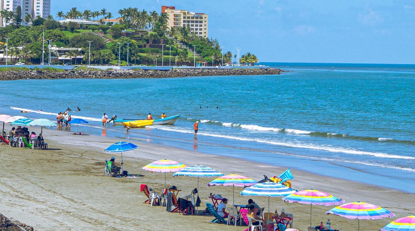
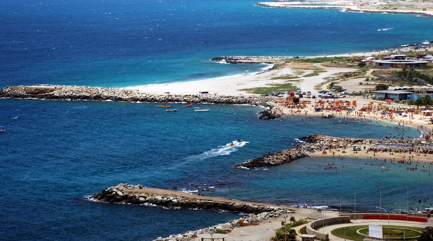
Nearby coastal areas include beaches and resort communities accessible along the same coastal highway. Common things to do include visiting the local social clubs and beaches, which see significant domestic tourism from Caracas. The state economy relies on a combination of port activity, customs operations, and coastal tourism rather than agriculture, given how little viable land the geography offers.
How Geography Influences Urban Form
The narrow coastal strip between the mountains and the sea left almost no room for La Guaira to develop in the way that most port cities do. Expansion has historically been constrained by the mountain wall to the south and the Caribbean Sea to the north.
This geographic pressure produced a dense, linear urban layout that follows the coast rather than spreading inland. The same geography that limited growth also made defense straightforward during the colonial era, with mountains on one side and fortified harbourworks on the other. For travelers, it means that the city reads differently from most Venezuelan urban centers: compact, layered, and visually dominated by the relationship between the mountains and the water.
Disaster History And Urban Change
The 1999 floods and mudslides are the single most consequential event in La Guaira’s modern history. They reshaped the physical city, changed its administrative status, and left a lasting mark on how residents and planners understand the region. Knowing this history is directly relevant if you are transiting through or spending time in the area.
The 1999 Flood And Mudslides
On December 15, 1999, following days of torrential rainfall, catastrophic flooding and mudslides struck the Caribbean coast of Venezuela. The state of La Guaira, then named Vargas, bore the most severe impact. Entire neighborhoods were buried or swept away, and the port and historic center sustained serious damage.
The disaster is referred to in Venezuela as the Vargas Tragedy. Death toll estimates vary widely, but the event ranks among the most destructive natural disasters in Venezuelan history. The town and port were badly damaged, and the scale of destruction fundamentally altered the urban landscape of La Guaira in ways still visible today.
How 1998 To 2001 Marked A Turning Point
The period from 1998 to 2001 marked a concentrated sequence of significant changes for La Guaira. In 1998, the state of Vargas was created from parts of the former Federal District of Caracas, and La Guaira became the state capital. The following year brought the 1999 disaster. The years immediately after were defined by emergency recovery, relocation of displaced residents, and debates over how and whether to rebuild in the most exposed areas.
What Travelers Should Understand About The Area Today
For travelers, the practical implications of 1999 are visible rather than dangerous. Parts of the coastal road and some older infrastructure date from the post-disaster reconstruction period. Some areas of the historic center show clear signs of damage that was never fully repaired.
Culture, Sports, And Present-Day Relevance
La Guaira maintains a distinct local identity that extends beyond its port and airport functions. Two sporting institutions, one in baseball and one in football, carry the city’s name into national prominence, and the city itself continues to function as the practical entry point for travelers heading toward Venezuela’s interior or its Caribbean coast.
Tiburones De La Guaira And The Venezuelan Professional Baseball League
The Tiburones de La Guaira, or Sharks of La Guaira, are the city’s professional baseball team competing in the Venezuelan Professional Baseball League. Founded in 1962, the team has won eight national championships and claimed the Caribbean Series title in the 2023-24 season.
Baseball is Venezuela’s most followed professional sport, and the Tiburones carry significant national recognition well beyond the city itself. Matching the team’s navy blue and gold colors to the name of a port city on the Caribbean coast is a connection that makes intuitive sense to most Venezuelans.
Deportivo La Guaira And Local Identity
Deportivo La Guaira is the city’s football club, representing La Guaira in Venezuelan football competitions. Like the baseball team, it extends the city’s name into a national sporting context and contributes to a local identity that residents maintain with clear pride despite the city’s relatively small size.
For a city of roughly 19,000 to 25,000 people in the urban core, La Guaira punches considerably above its weight in national sporting terms. Exploring the local stadiums is among the recommended things to do for sports fans. That local identity is worth acknowledging for travelers who tend to see the city only as a transit point.
Using La Guaira As A Travel Gateway Along The Venezuelan Coast
La Guaira is the practical starting point for nearly every international traveler entering Venezuela. Simón Bolívar International Airport in Maiquetía handles the overwhelming majority of international flights, and the coastal highway connects directly to Caracas and onward to destinations across the country.
For travelers planning journeys to Canaima, the Gran Sabana, Los Llanos, or the Orinoco Delta, La Guaira and Caracas form the natural entry sequence for discovering La Guaira in Venezuela. Coastal travel westward toward Morrocoy or eastward toward Mochima and Choroní also begins from this zone.
Frequently Asked Questions
Welcome to the FAQ section about La Guaira. Here you’ll find quick, useful answers about its culture, attractions, and local life.
The city of La Guaira had a recorded population of approximately 19,162 in the 2011 census, with the metropolitan area reaching around 270,792. Some more recent estimates place the urban population closer to 25,000, though figures vary across sources.
La Guaira is the capital city of La Guaira State, one of the 23 states of Venezuela. The state was previously named Vargas State until 2019, when it was renamed after its capital city.
La Guaira is approximately 25 kilometers from Caracas, connected by a mountain highway that descends from the coastal range. In light traffic the drive takes roughly 20 minutes, though congestion and weather conditions on the winding road can extend that time considerably. Pre-arranged transfers with a local operator are the most reliable option for new arrivals.
The Port of La Guaira sits on the northern coast and is a vital economic hub. Major landmarks include the colonial fortifications and the historic Guipuzcoana Company building. It remains the primary maritime gateway and is central to the history of La Guaira in Venezuela.
Simón Bolívar International Airport, located in the neighboring town of Maiquetía, serves La Guaira and the wider Caracas metropolitan area. It handles roughly 90 percent of Venezuela's international air traffic and sits just a short distance along the same coastal strip as La Guaira city.